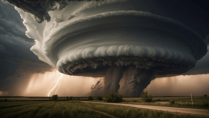
 ## Nature’s Most Violent Thunderstorm
Among all weather phenomena on Earth, few inspire as much awe and fear as tornadoes. While many storms can produce strong winds, hail, and lightning, the vast majority of the world’s most violent tornadoes are born from a specific and rare type of thunderstorm: the supercell.
Supercells ↗ are responsible for approximately 70% of all significant tornadoes (EF2 or stronger), despite making up a small fraction of total thunderstorms globally. These storms are long-lived, highly organized, and capable of producing destructive winds exceeding 300 mph, hail larger than baseballs, and tornadoes that remain on the ground for dozens of miles.
To understand tornadoes, one must first journey inside the supercell itself — a rotating atmospheric engine powered by instability, sculpted by wind shear, and fine-tuned by moisture and temperature contrasts.
What Is a Supercell?
A supercell is a thunderstorm distinguished by the presence of a deep, persistent, rotating updraft known as a mesocyclone. Unlike ordinary thunderstorms, which often collapse after 30–60 minutes, supercells can persist for several hours and travel hundreds of miles.
- Highly organized storm structure
- Long-lived rotating updraft (mesocyclone)
- Capable of producing large hail, damaging winds, and tornadoes
- Typically isolated rather than part of a large storm cluster
Supercells most commonly form in environments where warm, moist air near the surface is overlain by cooler, drier air aloft — a setup that creates intense atmospheric instability.
The Atmospheric Ingredients Behind Supercells
Tornado-producing supercells require a precise combination of atmospheric conditions. Meteorologists often describe these as the “four key ingredients.”
1. Moisture
Moisture fuels thunderstorms. Warm, humid air near the surface provides the water vapor necessary for cloud formation and latent heat release. In the United States, this moisture often originates from the Gulf of Mexico.
Surface dew points of 60–75°F (16–24°C) are commonly observed in tornadic environments.
2. Instability
Instability refers to the atmosphere’s tendency to support rising air parcels. It is often quantified using CAPE (Convective Available Potential Energy).
Tornadic supercells ↗ frequently develop in environments with CAPE values between 1,500 and 4,000 J/kg, indicating strong potential for explosive updrafts.
3. Lift
Some mechanism is required to initiate rising air. This can include cold fronts, drylines, warm fronts, or outflow boundaries. The lift helps air parcels reach their level of free convection, where they accelerate upward on their own.
4. Wind Shear
Wind shear — changes in wind speed and direction with height — is the most critical ingredient that separates supercells from ordinary storms. Strong vertical wind shear allows storms to rotate and sustain their updrafts.
The Powerhouse: The Supercell Updraft
At the heart of every supercell lies a powerful updraft capable of lifting air at speeds exceeding 100 mph. This updraft is what suspends large hailstones and allows storms to grow vertically beyond 50,000 feet.
Unlike non-rotating storms, the supercell updraft tilts due to wind shear, preventing precipitation from falling back into it. This separation of updraft and downdraft is a key reason supercells are so long-lived.
- Updraft speeds can exceed 45–50 m/s
- Storm tops often reach the stratosphere
- Supports giant hail formation
Wind Shear and the Birth of Rotation
Wind shear initially creates horizontal rotating tubes of air in the lower atmosphere. When the storm’s updraft tilts these tubes upright, rotation becomes vertically aligned — forming the mesocyclone.
Strong low-level wind shear, especially directional shear where winds turn clockwise with height, dramatically increases the likelihood of tornado formation.
The Mesocyclone: A Storm Within a Storm
The mesocyclone is a rotating column of air several miles wide, embedded within the supercell. Radar can detect mesocyclones by identifying velocity couplets — areas where winds are moving toward and away from the radar in close proximity.
Not all mesocyclones produce tornadoes, but nearly all strong tornadoes originate from mesocyclones.
- Diameter: 2–10 miles
- Rotation speeds: 20–40 mph
- Lifespan: tens of minutes to hours
Downdrafts: The Hidden Players
Two downdrafts play a crucial role in tornado formation: the Rear-Flank Downdraft (RFD) and the Forward-Flank Downdraft (FFD).
The RFD wraps around the mesocyclone, helping concentrate rotation near the ground. Research shows that warmer, less dense RFD air increases the likelihood of tornado genesis.
Condensation Funnels and Tornado Genesis
As rotation tightens and pressure drops near the surface, air cools and moisture condenses, forming a visible condensation funnel. A tornado is officially defined when this rotating column of air is in contact with the ground — even if no funnel is visible.
Tornado wind speeds range widely:
- EF0: 65–85 mph
- EF2: 111–135 mph
- EF5: Over 200 mph
Why Only Some Supercells Produce Tornadoes
Despite ideal conditions, only about 20–30% of supercells actually produce tornadoes. Small-scale factors such as boundary interactions, moisture depth, and downdraft temperature differences can make or break tornadogenesis.
Global Distribution of Supercells and Tornadoes
While the United States experiences more tornadoes than any other country — averaging 1,200 per year — supercells occur worldwide, including in Argentina, Bangladesh, South Africa, and Australia.
Conclusion: A Delicate Balance of Chaos
Tornado-producing supercells represent a delicate balance between order and chaos. They require just the right mix of moisture, instability, lift, and wind shear — and even then, tornado formation is never guaranteed.
By tracing the anatomy of the supercell, scientists continue to improve forecasting and warning systems, saving countless lives while deepening our understanding of Earth’s most powerful storms.
Frequently Asked Questions About Supercells and Tornadoes
What makes a supercell different from a regular thunderstorm?
A supercell contains a long-lived, rotating updraft called a mesocyclone. This rotation allows the storm to persist for hours, separate its updraft from downdrafts, and produce extreme weather such as large hail and strong tornadoes. Ordinary thunderstorms typically lack this organized rotation and collapse much more quickly.
Do all supercells produce tornadoes?
No. Only about 20–30% of supercells generate tornadoes. While a mesocyclone is necessary for most strong tornadoes, additional small-scale factors—such as downdraft temperature, surface boundaries, and low-level moisture—determine whether tornado genesis actually occurs.
What role does wind shear play in tornado formation?
Wind shear creates horizontal rotation in the atmosphere that can be tilted vertically by a storm’s updraft. Strong directional and speed shear, especially in the lowest mile of the atmosphere, greatly increases the likelihood of mesocyclone development and tornado formation.
What is a mesocyclone, and can it be seen visually?
A mesocyclone is a broad, rotating column of air within a supercell, typically several miles wide. While it is primarily detected by Doppler radar, it can sometimes be inferred visually by features such as a rotating wall cloud. However, the mesocyclone itself is usually invisible to the naked eye.
What is the difference between a funnel cloud and a tornado?
A funnel cloud is a rotating column of air that has not made contact with the ground. A tornado is officially classified when that rotating circulation reaches the surface, regardless of whether a visible funnel is present.
Why does the United States experience so many tornadoes?
The central United States has a unique geography that allows warm, moist air from the Gulf of Mexico to collide with cool, dry air from Canada and the Rocky Mountains. This frequent combination of moisture, instability, lift, and strong wind shear creates ideal conditions for supercells and tornadoes.
Can scientists predict exactly when and where a tornado will form?
While meteorologists can forecast environments favorable for tornadoes and identify rotating storms in real time, predicting the exact timing and location of tornado formation remains extremely challenging. Tornadogenesis depends on very small-scale processes that are difficult to observe and model.
Are supercells becoming more common due to climate change?
Research suggests that atmospheric instability and moisture may increase in a warming climate, but wind shear patterns may decrease or shift geographically. As a result, scientists are still uncertain how climate change will affect the overall frequency and distribution of supercells and tornadoes.
Supercell thunderstorms represent one of the most complex and powerful ↗ expressions of Earth’s atmosphere, combining instability, moisture, lift, and wind shear into a finely tuned system capable of producing catastrophic tornadoes. Understanding the anatomy of a supercell—from its explosive updrafts and deep mesocyclones to the subtle interactions of downdrafts and surface boundaries— is essential not only for meteorologists, but for public safety and severe weather preparedness worldwide. As radar technology, storm-scale modeling, and observational science continue to advance, our ability to anticipate tornadogenesis improves, offering earlier warnings and saving lives. Yet, each supercell remains a reminder of how narrow the margin is between a powerful thunderstorm and a violent tornado, governed by processes that unfold on scales both vast and microscopic within the atmosphere.